Frequently asked questions
- What is LidarKit?
- A free set of browser-based tools for working with LiDAR files: converting between LAS and LAZ and from E57, viewing LAS, LAZ, COPC, E57 and PLY point clouds in 3D, opening GeoTIFF DEMs and orthophotos, reading a LAS or LAZ file's header and coordinate system, classifying ground, vegetation and buildings, turning a point cloud into an elevation model or an orthophoto, and comparing two DEMs or two point clouds. Everything runs on your own machine — there is no account and nothing to install.
- Are my files uploaded anywhere?
- No. There is no upload endpoint and no server component — this is a static site, and every tool runs on your own machine: the LAS and LAZ tools through a WebAssembly build of laz-perf in a Web Worker, the E57, PLY and GeoTIFF readers in plain JavaScript. Once a tool has loaded its code it keeps working with your network disconnected, which is the simplest way to verify the claim yourself.
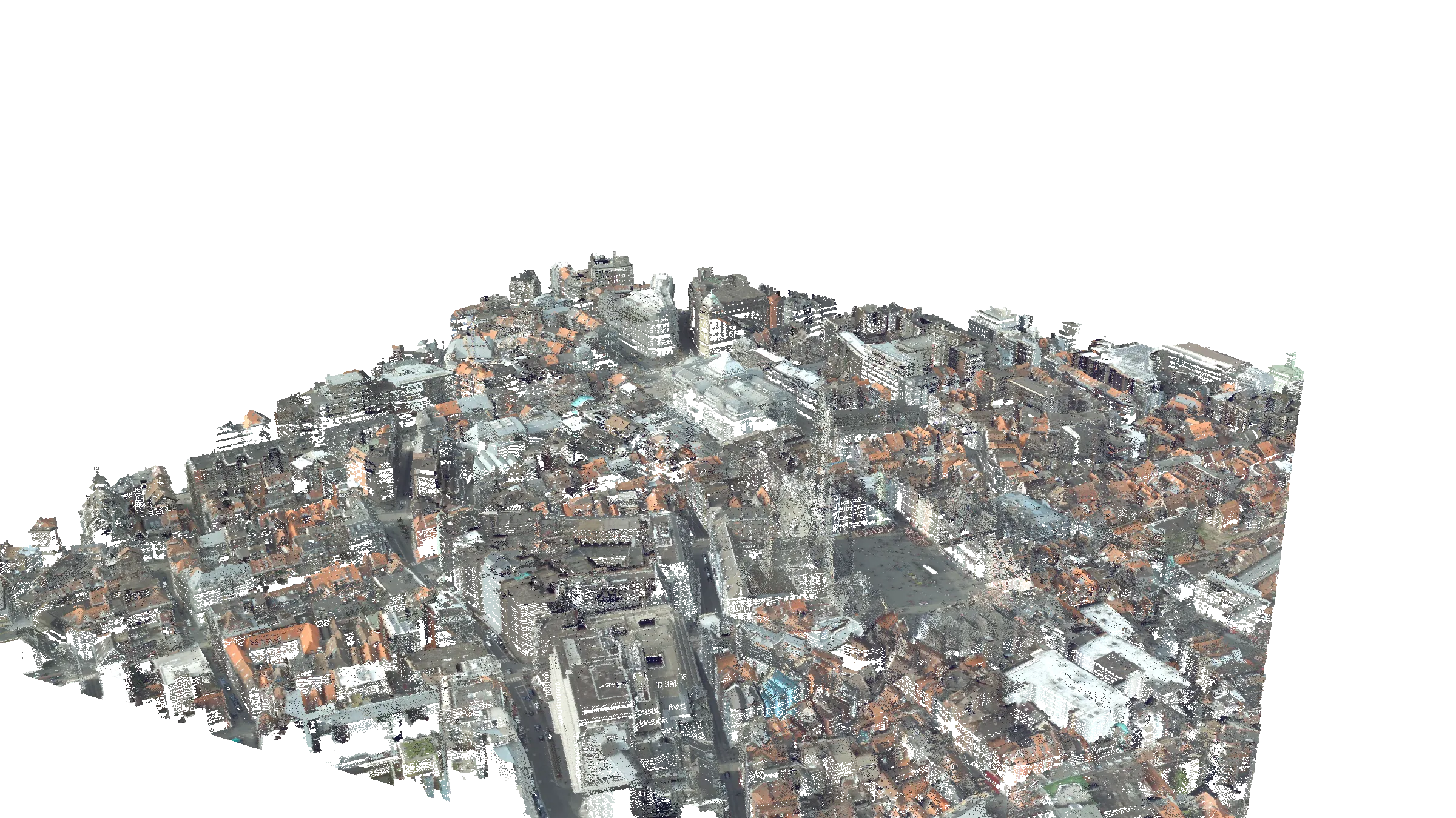
- What is the point cloud on this page?
- Brussels city centre, Brussels, Belgium, from a 2014 airborne LiDAR survey coloured with aerial imagery. The page first shows a picture rendered from all six million points; on a desktop connection the same viewer you can open your own files in then loads the cloud behind it and takes over, so you can drag to orbit. Phones and data-saver connections keep the picture. Either way, "Explore this point cloud" opens it in the COPC viewer with the full controls.
- Which file formats can I open?
- LAS and LAZ from version 1.0 to 1.4, in point data record formats 0, 1, 2, 3, 6, 7 and 8, including extra bytes; COPC (.copc.laz) octrees, from a local file or streamed from a URL; E57 laser scans, including multi-scan projects; PLY point clouds, meshes and Gaussian splats, in ASCII or binary; and GeoTIFF rasters, both elevation models and orthophotos. Point formats 4, 5, 9 and 10 store full waveform data, which laz-perf does not support, so those are detected and reported rather than silently mishandled.
- What can I get out, as a file?
- LAS or LAZ from the converters and the classifier, in any combination of input and output — the point data, header, coordinate system and extra bytes all survive. From the gridding and comparison tools, GeoTIFF: single-band Float32 for a surface, terrain or difference model, with nodata set, and four-band RGBA for an orthophoto. All are tiled and compressed, and all carry the coordinate system the source file declared, so they open in the right place in QGIS, ArcGIS or anything else built on GDAL.
- Is there a file size limit?
- No fixed limit. Files are read in chunks and results are streamed to a temporary file in the browser's private file system, so peak memory stays at a few megabytes whether the input is 50 MB or 50 GB; a browser without that file system assembles the result in memory instead, and available RAM becomes the ceiling. Multi-gigabyte point clouds are the case these tools were built for; the practical limit is your free disk space.
- Do I need an account, or to install anything?
- Neither. There are no accounts, no sign-in, no extension and no download — open a page and drop a file on it. Nothing is stored on your device beyond the browser's ordinary cache and the temporary output file, which is released when you leave the page.
- Is it free, and what is the catch?
- It is free to use with no feature gates and no trial, and it is not going behind a login. The site is intended to be supported by advertising rather than by charging for the tools; because processing is local there are no per-file costs to recover.
Sample data: Brussels city centre, Brussels, Belgium. Airborne LiDAR survey, 2014, coloured from aerial imagery.